Fort Munro hill station, located at a height of 6,470 feet above sea level, is about 185 kilometres from Multan and around 85 kilometres from Dera Ghazi Khan in Suleiman Mountain Range. Fort Munro is just beyond the Punjab border. The term ‘fort’ seems somewhat  exaggerated since the town looks more like a peaceful hill resort with gardens and orchards rather than a military outpost. The town was founded by Sir Robert Sandeman (left) in the later part of the 19th century and named Fort Munro after Colonel Munro who was commissioner of the Derajat Division. It attracts a number of tourists every year, particularly those who wish to escape from hot plains of southern Punjab to enjoy mild and pleasant weather for a day or two. The Punjab Government has planned a Rs735 million cable car system and allied facilities project, which is expected to kick off soon to attract people from surrounding areas being the only hill station of southern Punjab in Dera Ghazi Khan district. The cable car would start from Khar, a small settlement at the foot of Fort Munro, and go up to Fort Munro after a stopover at TDCP motel. TDCP resort offers excellent boating on the Dames Lake.
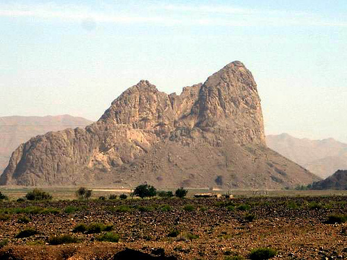
Fort Munro is par of the Sulaiman Mountain range. The range is located in central Pakistan, extending southward about 280 miles (450 km) from the Gumal Pass to just north of Jacobabad, separating the North-West Frontier Province and Punjab from Balochistan. Its heights gradually decrease toward the south, with summits averaging 6,000–7,000 feet, the highest being the twin peaks (30 miles from the Gumal Pass) called Takht-i Sulaiman, or Solomon’s Throne, which legend connects with King Solomon’s visit to Pakistan; the higher of the peaks, at 18,481 feet (5,633 m), is the site of a Muslim Ziyarat (shrine) visited annually by many pilgrims. The range’s eastern face dips steeply to the Indus River, but on the west the range declines more gradually. Juniper and edible pines abound in the north and olives in the centre, but vegetation is scarce in the south. The Ghat, Zao, Chuhar Khel Dhana, and Sakhi Sarwar are the principal passes in the north. In the south, west of Dera Ghazi Khan, lies the hill station of Fort Munro.
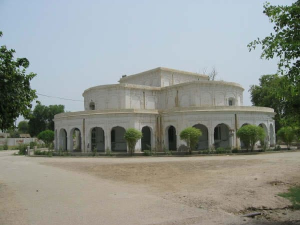
The small little town rests atop the hill feature over looking the entire valley. The old British day buildings still stand majestically, one is being used by the political agent (PA) and the other is being used as a guest house. In the lawn adjacent to the guest house is a small grave yard which has graves of families of the British officers who died during their stay here.
Fort Munro can be reached either from Loralai (Balochistan) or from Multan (Punjab). From Punjab, the mountain range starts near Rakhni, which is a border-post  between Balochistan and Punjab. One can see the signs of both the provinces in the shops. There are fertile green fields of cotton on both sides of the road. From Rakhni onwards the flatland gives way to the hills and the climb starts towards Fort Munro. The road is in good shape and the climb is at a comfortable gradient, save for some sharp bends and switchbacks as it criss-crosses through the mountains. The road rises steeply and rises to about 1600 Metres. The road then approaches a crossing, the right fork leading towards Fort Munro, while the left fork goes on to Dera Ghazi Khan.
The area is largely inhabited by Baloch tribes. In 1950, a merger of Balochi tribes with the Punjab was arrived at and a stone was erected atop the Fort Munro highest hill feature to commemorate the historic occasion.