Narowal is a district of province Punjab, Pakistan, located on the north of Indian Occupied Kashmir’s district Kathua, on the by Pathankot, on the south by Amritsar (District of India), and on the northwest by the district of Sheikhupura. The region coordinates are 32’ 6’26’’ in the north and 74’52’7” in the east.
The capital of the district is Narowal City which is considered to be 94th largest city of Pakistan. The area is 2,337sq km while according to the 1998 census of Pakistan, the district population was about 1,256,102 among which 12 per cent was urban.
The population contain the majority of Muslims due to the missionary Sufi Saints of the region. The article contains all the information about the city, including Narowal History.
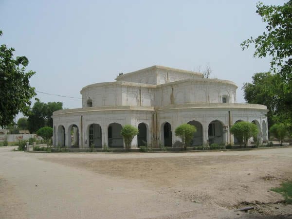
During British Rule Narowal was a town of the Rayya Tehsil of Sialkot District after independence from Britain in 1947 Narowal became Tehsil headquarters – in 1991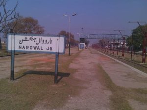 the district of Sialkot was bifurcated, Narowal then became the capital of the newly formed Narowal District, This is the historical place where Jagat Guru Nanak Ji departed from this world on 23rd Assu, Samvat 1596 (22nd Sept. 1529 AD). It is also called Dera Nanak Baba. Dera Sahib railway station, on Lahore-Narowal section, serves this place. The Shrine is located by the River Ravi within a distance of nine kilometers from the railway station. The present building was built at a cost of Rs.1,35,600, donated by Sardar Popindar Singh, the Maharaja of Patiala. It was repaired by the Govt. of Pakistan in 1995 incurring expenditure in lacs of rupees. It has a spacious and beautiful building. Its location beside a forest and river Ravi makes its care difficult.
Narowal District takes its name from its headquarters town. It is divided into two Tehsils viz Narowal and Shakargarh. Before coming into being the district, both Narowal and Shakargarh were the Tehsils of the district Sialkot. In 1991, Narowal district was created comprising Narowal and Shakargarh tehsils. Before independence of Pakistan, Shakargarh town was the headquarters of Tehsil Shakargarh, which formed part of Gurdaspur district. Under the Radcliff Award, Shakargarh Tehsil was transferred to Pakistan and attached with Sialkot district. Then in 1991, Shakargarh was attached with Narowal district. Now Shakargarh is functioning as Tehsil in District Narowal. Narowal is functioning as a separate administrative district with effect from July 1, 1991.
Location
It lies from 31° 55′ to 32° 30′ north latitudes and 74° 35′ to 75° 21′ east longitudes. The district is bound on the northwest by Sialkot district, on the north by Jammu State, on the east by Gurdaspur district (India) and on the south by Amritsar district (India) and Sheikhupura district.
Area
The total area of the district is approximately 2337 square kilometers. Narowal Tehsil occupies 1065 square kilometers while the remaining area falls in Shakargarh Tehsil.
Narowal History Introduction
Narowal District takes its name from its headquarters town. It is divided into Three Tehsils vis Narowal, Zafarwal and Shakargarh. Before coming into being the district, both Narowal and Shakargarh were theTehsils of the district Sialkot. In 1991, Narowal district was created comprising Narowal and Shakargarh tehsils. Before independence of Pakistan, Shakargarh town was the headquarters of Tehsil Shakargarh, which formed part of Gurdaspur district. Under the Radcliff Award, Shakargarh tehsil was transferred to Pakistan and attached with Sialkot district. Then in 1991, Shakargarh was attached with Narowal district. Now Shakargarh is functioning as tehsil in District Narowal. Narowal is functioning as a separate administrative district with effect from July 1, 1991.
Location:
It lies from 31º- 55? to 32º- 30? north latitudes and 74º- 35? to 75º- 21? east longitude.
Boundaries:
The district is bounded on the north – west by Sialkot district, on the north by Jammu State, on the east by Gurdaspur district (India) and Sheikupura district.
Area:
The total area of the district is approximately 2,337 square kilometers. Narowal tehsil occupies 1,065 square kilometers, while remaining area falls in Shakargarh tehsil.
Physical Features:
The general aspect of the district is a plain slopping down from the uplands at the base of Himalayas to the level country to the south ? west, and the general altitude is 266 metres above the sea level. Bounded on south – east by the river Ravi, the district is fringed on either side by a line of fresh alluvial soil, about which rise the low banks that form the limits of the riverbeds. At about a distance of 24 kilometres from Ravi, another stream, the Dake ? which rises in the Jammu hills ? traverses this district. The district is practically a level plain throughout. Its north ? eastern boundary is at a distance of about 32 kilometres from the outer line of the Himalayas. But the foot ? hills stop short of the district and its surface is level plain, broken only by the river Ravi, by the Aik and Dake streams and a few nullahs. There are differences in water level, which facilitates in well ? irrigation. But generally, the physical aspects of the district present little variety. It is fertile and its dense population ensures that almost every available acre is brought under the plough.
Climate:
The district has extremes of climate. The summer season starts from April and continues till October. The hottest months are May, June and July. The mean maximum and minimum temperature during these months are 40 and 24 degrees respectively.
History:
According to a legend, the town Narowal was founded by, one Baba Naro Bajwa some 900 years ago. The town was, then surrounded by 22 villages inhibited by a Jat clan only, known as Bajwa.
Syed Habib Shah son of Inayat Ullah Shah assisted Naro in the development and establishment of the town. He brought and settled a big chunk of population of Aroud and Kamboh castes.
Baba Naro occupied the northern portion of Narowal and Syed Habib Ullah Shah and his followers consisting of various muslim clans inhibited southern portion.
During the Sikh regime, Sikh Sardars took hold of major part of the fertile land and annexed the Narowal town to Rayya Khas Tehsil of district Amritsar, some 100 years back.
Before independence of Pakistan, Shakargarh town was headquarters of tehsil Shakargarh, which formed part of Gurdaspur district. Under the Radcliff Award, Shakargarh tehsil was transferred to Pakistan and attached with Sialkot district.
Previously Zafarwal and Rayya formed separate tehsil headquarters. In about 1927, some adjustments in the territorial jurisdiction of the tehsils and districts were made, when Narowal came into existence as the tehsil headquarters and Zafarwal and Rayya were merged in it.