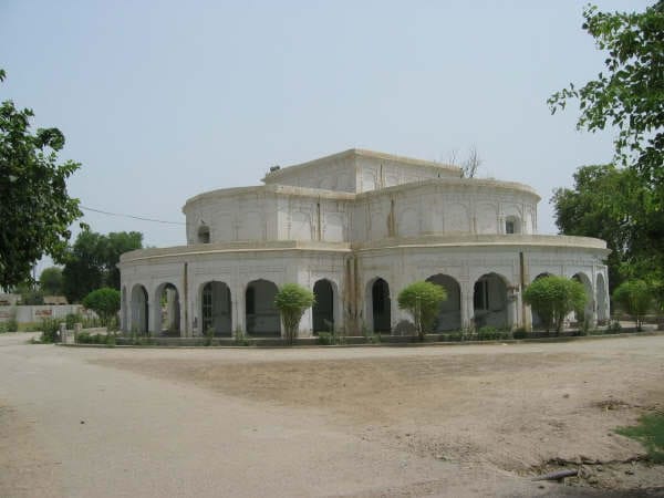
Sukkur in Archives: Sakhar, or Sukkur as commonly written but pronounced as the former had been a town situated on the right bank of the Indus, and part of Sind province even before the British India. It commanded the trade of Sind, and the river was once crossed by a cantilever bridge carrying the North-Western railway to Kotri in the early 20th century. In 1842 it came under British rule. The District Of Sukkur was created in 1901 out of part of Shikarpur district, the remainder of which was formed into the district of Larkana. It is chiefly alluvial plain, but there are slight hills at Sukkur and Rohri. In the higher-lying parts are salt lands, or even desert in the area known as the Rajistan. The climate is hot, dry and enervating. The population in 1901 was 523,345, showing an increase of 10% in the decade. A considerable part of the district is irrigated, the principal crops being wheat, millets, rice, pulses and oil seeds. Earthen, leathern and metal ware, cotton cloth and tussore silk are manufactured, also pipe-bowls, snuff-boxes and scissors. Lines of the North-Western railway serve the district, and there is a branch from Sukkur towards Quetta. Sukkur was and still continues to be a junction point for railway system for Quetta via Sibi and Jacobabad, while another highway and railway line go via Rahimyar Khan and Sadiqabad straight to Multan. Sukkur is a sprawling town, with beautiful mosques, gardens, shrines and madrazhis (Muslim religious schools). A desert oasis town, similar to Jaisalmer in Rajasthan, it also boasts many havelis, however, unlike those of Jaisalmer, the Sukkur variety are decorated with geometric, floral designs and painted in a variety of bright, contrasting colors. Just across the Indus is Rohri, also fairly prosperous and an important rail and road junction. The two towns, 5 km apart and 544 km north of Karachi are linked by the Landsdowne and Ayub bridges, which are extremely beautiful. There is a medieval mosque with porcelain-tiled walls, and eight km away are remains of the ancient city of Aror where Alexander the Great is said to have camped.
Sukkur has been an important strategic centre and trading route from time immemorial. Alor (present Aror, Sukkur) held the status of capital under the reign of Musikanos, when Alexander invaded India in 326 BCE. The ruins of this ancient town still exist, 8 km east of Rohri, in Sukkur district. In 711 AD, Muhammad Bin Qasim led a Muslim army and invaded Sindh, whole os Sindh (including Sukkur) and lower Punjab became part of Umayyad Caliphate. Later Mughals and many semi-autonomous tribes ruled over Sukkur. The city was ceded to Mirs of Khairpur between 1809 and 1824. In 1833, Shah Shuja (a warlord of Kandahar, Afghanistan) defeated the Talpurs near Sukkur and later made a solemn treaty with the Talpur ruler, by which he relinquished all claims on Sindh. In 1843, the British general, Charles James Napier, defeated the Talpurs at the battle of Miani and Dubbo near Hyderabad and ruled Sind, including Sukkur until independence of Pakistan.
In 1923, world’s biggest irrigation of that times was laid by the British with the construction of the famous Sukkur barrage (formally called Lloyd Bridge), on the Indus river. The work for the bridge was started in 1923 and completed in January 1932. The 5,000 feet long barrage is made of yellow stone and steel and can water nearly 10 million acres (40,000 km²) of farmland through its large seven canals. Some of the canals are larger than the Suez Canal.
Sukkur as it is now is the third largest city of Sindh. The name read as Suk-khar is a local variant of Arabic word “Saqar” which means intense. In the 10th century AD when Arabs invaded Sukkur), they found extreme (hot and cold) climate, and called it “Saqar”. Sukkur is also known as “Darya Dino” in local Sindhi language, meaning the the gift of river,
as without the Indus this would be like Egypt deprived of Nile. Sukkur district shares northern border with Shikarpur and (recently constituted) Kashmore districts. Ghokti is located on the north-eastern side while Khairpur on the south. Sukkur also shares its border with India (Jaisalmir, Rajasthan). Sukkur is also connected by road air with all major cities of Pakistan.
At the time of Pakistan’s independence (1947), Sukkur district was comprised approximately 200,000 habitants, mostly engaged in agricultural pursuits and fishing industry. Over time, Sukkur has seen a moderate rise in population (2 to 2.5% per annum) as compare to Pakistan’s, except in late 60s and early 70s when population growth rate reached 4.43% (1972 census) due to internal migration and establishment of some large bridges on river Indus. According to official census of 1998, Sukkur has a population of 908,370. Besides 96% Muslims, Sukkur also has relatively greater proportion of Hindus, mostly settled in urban areas and engaged in trade and services sector. Ethnically Sindhis share the biggest segment of population (74%), followed by Muhajirs – refugees from India upon partition of British India (14%). Sukkur is also domicile of many Baloch tribes, including, Rindh, Chandio, Khoso and Laghari. Amongst others, there are Memon, Punjabi and Siraiki sections. Traditionally Memons were associated with trade and retail business but during last two decades they have ascended as an active social and economic front.
Sukkur is a hub of many small and large scale industries. Among important industries are cotton textiles, cement, leather, tobacco, paint and varnish, pharmaceuticals, agriculture implements, hand pumps, lock making, rice-husking, and sugar. Small-scale cottage industries comprise hosiery, boat making, fishing accessories, thread ball spooling, trunk making brass-wares, cutlery and ceramics. Being an agricultural city, crops like rice, maize, cotton, tomatoes, peas wheat, barley, gram and melons are sown here. Sukkur is famous world over, for its delicious dates. Sukkur also holds a large number of riverine forest on the course of Indus. These tropical forests are found within the protective embankments on either side of Indus. During 1997-98 the total area under forests was 510 km² which yielded 55,000 cubic feet (1600 m³) of timber and 27000 cubic feet (760 m³) of firewood besides other miner products.